
釣りのための参考情報であって、航海用ではありません。 区域の境界や水深には誤差があり、最新でないこともあります。航海の判断は、海上保安庁の海図と最新の水路通報・航行警報でお願いします。規制の内容そのものは、必ず公式の情報で確認してください。
This is reference information for fishing, not for navigation. Boundaries and depths may be inaccurate or out of date. Base navigational decisions on Japan Coast Guard charts and the latest notices to mariners and navigational warnings. Always check the substance of any regulation against official sources.
1. ON にする
地図右上のレイヤーメニュー(標準 / 航空写真を切り替えるのと同じ場所)で「海のマップ」を ON にします。ズーム7〜16で表示されます。右下のボタンから、グループごとの表示切替と等深線の色の凡例を開けます。
Open the layers menu at the top-right of the map — the same place you switch between standard and satellite — and turn on Sea chart. It draws between zoom levels 7 and 16. The button at the bottom-right toggles each group and opens the colour key for the contours.
レイヤーは3グループに分かれていて、それぞれ独立に切り替えられます。Gold 未満では ON にできません。
The layers come in three groups you can toggle independently. Below Gold it cannot be turned on.
2. 重ねると、地図はこう見える
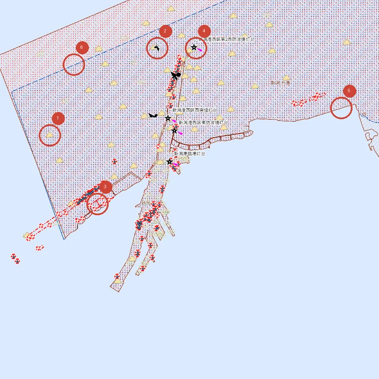
- 1底質:砂
- 2沈船
- 3海底障害物(魚礁など)
- 4灯台
- 5港則法の港域(赤い縦線のハッチ)
- 6港湾区域の境界(青い点のハッチの外縁)
3. 規制・区域の記号
船の通航や錨泊について、法令で区域が決められているところです。面として描かれ、種類ごとに色とハッチ(模様)が違います。
Areas where navigation or anchoring is defined by law. They are drawn as areas, each with its own colour and hatching.
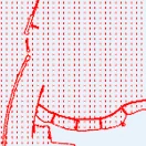
港則法の港域
港則法が適用される港の区域。赤い縦線のハッチ。
The area of a port to which the Act on Port Regulations applies. Red vertical hatching.
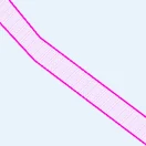
港則法の航路
港の中に定められた航路。マゼンタの細長い帯。
A fairway laid down inside a port. A long magenta band.
大きな船が通ります。
Large vessels use these.
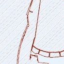
港則法のびょう地
港の中で錨泊の場所として定められた区域。灰色の斜線ハッチ。
An area set aside inside a port for anchoring. Grey diagonal hatching.
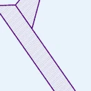
海交法の航路
海上交通安全法で定められた航路(浦賀水道航路など)。紫の太線。
A route under the Maritime Traffic Safety Act, such as the Uraga Suido Traffic Route. Heavy purple lines.
航行量が非常に多い海域です。
Very busy waters.
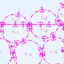
指定錨地
錨泊のために指定された場所。錨のマークと番号(T-1 など)が付きます。
A berth designated for anchoring. Marked with an anchor symbol and a number such as T-1.
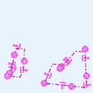
検疫錨地
検疫のための錨地として定められた区域。
An anchorage set aside for quarantine.
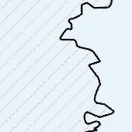
米軍演習区域
在日米軍の演習区域として設定されている区域。黒い実線と灰色の斜線。
An area set aside for US forces exercises. A solid black boundary with grey diagonal hatching.
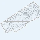
投棄区域
投棄について定められている区域。灰色の点線の囲み。
An area defined for disposal. A dotted grey outline.
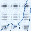
港湾区域
港湾法にもとづく港湾の区域。青い点のハッチ。
A port area under the Port and Harbour Act. Blue dotted hatching.
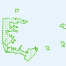
漁港区域
漁港漁場整備法にもとづく漁港の区域。緑の点のハッチ。
A fishing port area under the Fishing Ports and Grounds Act. Green dotted hatching.
4. 航路標識・障害物の記号
灯台などの標識と、海底にあるものです。点として描かれます。
Lights and other marks, and things on the seabed. These are drawn as points.
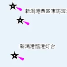
灯台
★の記号。名称が添えられ、光の向きが筋で描かれます。
A ★ symbol with its name alongside, and a ray showing the direction of the light.
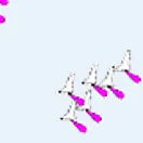
灯浮標
海上に浮かべた標識(ブイ)。
A floating mark — a buoy — on the water.
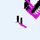
灯標
岩礁などに固定された標識。黒い柱とマゼンタの光。
A mark fixed to a rock or shoal. A black post with a magenta light.
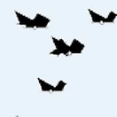
沈船
沈んでいる船。黒い船の形の記号です。
A sunken vessel. A black ship-shaped symbol.
地図でいちばん目に付く黒い記号がこれです。
This is the conspicuous black symbol you see on the map.
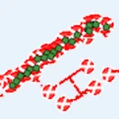
海底障害物
魚礁・沈錘など、海底にある障害物。赤と緑の小さな記号の集まり。
Obstructions on the seabed such as fish reefs and sinkers. Clusters of small red and green marks.
魚礁はこの記号で出ます。
Fish reefs appear as this symbol.
5. 底質の記号
海底が何でできているかです。等深線と同じグループに入っているので、等深線を出すと一緒に出ます。
What the seabed is made of. These sit in the same group as the depth contours, so they appear together with them.
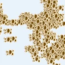
岩
海底が岩。黄土色の記号がびっしり並びます。
A rocky bottom. Dense ochre symbols.
根がかりしやすい一方、根魚の付き場です。
Easy to snag on — and where rockfish hold.
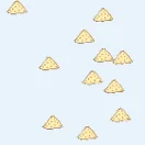
砂
海底が砂。黄色い山形の記号。
A sandy bottom. Yellow mound-shaped symbols.
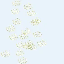
泥
海底が泥。細かい点の集まり。
A muddy bottom. Clusters of fine dots.
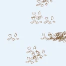
礫
海底が礫(小石)。
A gravelly bottom — small stones.
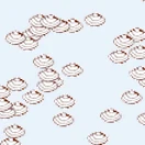
貝殻
海底が貝殻まじり。
A bottom mixed with shells.
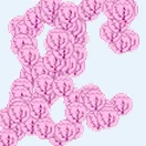
さんご
海底がさんご。ピンクの記号。
A coral bottom. Pink symbols.
南西諸島で多く出ます。
Common around the Nansei Islands.
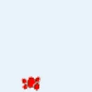
溶岩
海底が溶岩。赤い小さな記号。
A lava bottom. Small red marks.
伊豆諸島など火山性の海域で出ます。
Seen in volcanic waters such as the Izu Islands.
6. 等深線の色
アプリのレイヤーシートに出る凡例と同じです。浅いほど淡く、深いほど濃くなります。
The same key you see in the app's layer sheet. The shallower the line, the paler it is.
底質と等深線は同じグループだよ。
等深線を消すと砂や岩の記号も
一緒に消えるから注意してね。

7. 覚えておきたいこと
- Fishery-right areas are not shown. They come from a different provider and commercial use requires prefectural permission.
- The symbols are drawn by MSIL and overlaid as they are. Some appear only at certain zoom levels.
- To see depth itself as a surface, use the seafloor map in the same layers menu.
- For instruments and tracks while you are out on the water, see Boat Mode.
海のマップと出船モードを実画面で紹介する約2分の動画も公開しています(英語ナレーション・英語字幕): 紹介動画を YouTube で見る。アプリからは、海のマップのレイヤーシートと、ロック中の案内からも開けます。
There is also a two-minute video tour of the Marine map and Boat Mode, filmed on the real app (English narration and captions): watch the video on YouTube. In the app you can open it from the Marine map's layer sheet and from the locked-feature notice.
出典:海洋状況表示システム(海上保安庁・https://www.msil.go.jp/ )を加工して作成。このサービスは、海しるAPIを利用して取得した情報をもとに作成しているが、サービスの内容は海上保安庁によって保証されたものではない。
Source: Marine Situational Indication Linkages (MSIL), Japan Coast Guard (https://www.msil.go.jp/ ), processed. This service is built on information obtained via the MSIL API; its content is not guaranteed by the Japan Coast Guard.